Showing posts with label region. Show all posts

Friday, November 1, 2013

WHY we teach REGIONS of Colorado

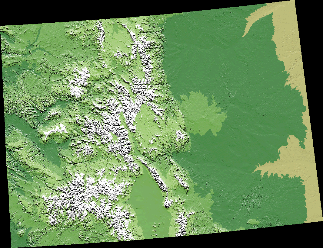
Traditionally, when teachers begin their study of Colorado, they help students to examine the physical landscape.  Through this examination, students apply the geographic concept of region.  From this map, kids can get a birds-eye view of our state without the buildings and without the people.  The natural landscape reveals some patterns that allow us to recognize the different regions we have in our state (plains, plateaus, and mountains).
But why do we invite students to understand the physical geography of our state?  What's the point?  I think the National Geography Standards: Geography for Life give us clues to the relevance of learning about our state's geography.  Students learn how to apply geography to interpret the past.  

Learning about the physical geography of Colorado's regions means that students understand the physical characteristics of places and environments are the settings for events in the past, present, and future.  Imagine great books without the setting. Simply stated, the setting is critical to a deep understanding of the story.

As students learn about the complex story of Colorado's past, it's crucial that they incorporate a rich understanding of our state's geography.  
  • How does a student connect with the Ancestral Puebloan, Ute and Arapaho native cultures without knowing about the Great Plains?  
  • How does a student feel the struggle of a trader, trapper, or mountain man without sensing a life within the mountains and plateaus? 
  • How does a student understand farm life and settlement during the Homestead Act without feeling the vastness of the plains?  
  • How does a student understand the development of Denver without recognizing how our water supply is uniquely connected to flowing water from the Continental Divide down to the Great Plains?  
Our history is intertwined with our geography and students have a deeper understanding of Colorado's past, present, and future when they see the influence of physical geography.  The question is, "How will you, as a teacher, help students to recognize this connection knowing that it supports a richer understanding of history?"


Saturday, August 10, 2013

Physical Geography and the Great Plains Region

My recent discovery is a tool called ThingLink; it was used to add the resources to the image you see in this posting.  ThingLink is definitely my new favorite tool...endless possibilities for instruction, especially schools moving to 1:1 instruction.

Conceptual ideas Within the Image
This collection of resources about the Great Plains might be used to help students explore the geographic concept of "region." Students might use the attached resources to answer such questions as:
1. If the Great Plains is a geographic region, how would you describe "region"?
2. How would you describe the Great Plains region?
3. What are some examples of the impact this region's physical geography has on wildlife and people?
4. How would you compare the Great Plains region to ____(different region here)___?

Application of Skills and Thinking Processes 
that Might Be Developed Using These Resources
1. Organize information using a variety of graphic organizers.
2. Analysis of maps and other geographic sources.
3. Describing a region and comparing/contrasting regions of Colorado, the United States and the world.

* * * * What other resources might you want to see added to this ThingLink so it's useful for students in 4th grade? * * * *

(Click on the links embedded into this image.)

Thursday, May 23, 2013

How does physical geography support understanding the geographic concept of region?

In your mind, using your mental map, how do you picture the United States?  Do you picture individual states or do you picture a set of states within a region?  Why do you think you have a mental picture of the United States by region?  One...you probably connect to characteristics connected to human geography (regions with political dispositions, regions with unique ethnic populations, regions with varying economic patterns, regions with different population density).  You might also view U.S. regions in a particular way because of how you associate physical features, climate, and weather patterns with different regions.

When teachers support students in developing the geography concept of region, we often begin with physical geography.  Physical geography allows students to consider facets such as landforms and climate.  In addition, we can begin to understand how weather patterns help students to develop an understanding of region. 

With recent news, people around the nation and the world are connected to the impact of tornados (physical geography, weather patterns) on people (human geography).  As someone from Denver, I watch the stories about this phenomena and have some connection knowing that a number of tornados occur in the plains region of Colorado.  Still, I often look at tornados as something that's connected to the midwest region and southeast region.  Imagine if you were watching these news stories from California, would you have a connection?  Probably not, and you would most likely associate this weather pattern with other regions in the United States.  In contrast, I associate forest fires with Colorado and the west region.  I associate hurricanes with the southeast region, portions of the southwest, and, increasingly, with the northeast. 

What regions do you think of when you hear about...drought? Blizzards?  Ice storms? El Nino? Hurricanes? Excessive heat?  Excessive humidity?

If we can support students in thinking through the conceptual lens of region, then we connect them to a deeper geographic understanding of the world.  Below, find some geographic tools to help support this learning with students who are beginning to explore regions of the United States.

(Note: I debated titling this posting Get Rid of Old Fashioned Fact-Based State Studies, Become a More Concept-Based Geography Teacher and Help Students Think About the United States Through the Concept of Region)

Links:

Find out about the deadliest and costliest hurricanes to strike the United States, in this LiveScience infographic.
Source:LiveScience